You can now move around using the arrow keys or up and down using the + and - keys.
Go to DEM > Make CA Starting Plot.
Write down the width and height it tells you to make the course architect plot.
Close Terrain Assist.
Creating the Plot
Open the Course Architect.
Go to File > New.
Give the course a name, enter the dimensions you wrote down, and click OK.
Go to File > Save As.
Name it flat.ach
Close the Course Architect.
Exporting the Elevation Data
Open Terrain Assist.
Go to File > Existing Project.
Find the project under the name you saved and open it.
Go to DEM > Import 3DEM.
Go to DEM > Export DEM to CA.
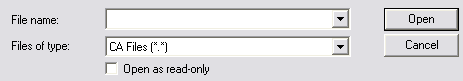
Under file type select CA File (*.*)
Open the flat.ach file you saved.
Change Save as type to CA File (*.*)
Give it a new name with an .ach extension on the end and save it.
The new plot now has all of the elevations on it.
Drawing Shapes
You can also use Terrain Assist to draw shapes instead of using Ghost It. The advantage to this is you don't have to keep adjusting your image every time you change the view. In order to have the image line up correctly in Terrain Assist it must match your plot size exactly. For more on how to do this, see the Terrain and Imagery Download tutorial.
Opening the Image
Go to DEM > Import Photo.
Pick one of the images you cropped to the same size as the plot.
Drawing Shapes
Click on Image > Draw Shapes.
Left click to add a point for a shape.
Right click to remove the last point added.
Push the arrow keys to move around or the + and - keys to zoom in and out.
When you finish drawing the shape push control and give the shape a name.
Repeat for each shape you want to draw.
Exporting Shapes to Your Plot
When you export shapes to a plot, any shapes on that plot must be dropped. If there are any that are not dropped the resulting plot becomes corrupted.
When you have finished drawing shapes, push the space bar.
Click on Export Shapes.
Select your saved shapes. You can only select 12 shapes at a time.
If you want to select more then 12 shapes click Queue to add more.
When you have selected all of the shapes you want click export.
A reminder appears that any shapes on the plot you select must be dropped. Click OK.
Under file type select CA File (*.*)
Select the ach file you want to export the shapes to and click open.
Change Save as type to CA File (*.*)
Give the new plot a new name with an .ach extension on it.
When you are finished push space bar to either exit to 3D view or exit Terrain Assist completely.