![]()
The USGS has a site called the Seamless Data Distribution System. This site makes it easy to download USGS data.
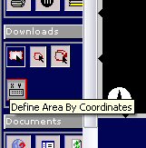
Next choose what you want to download.
Below, some of the useful choices are listed.
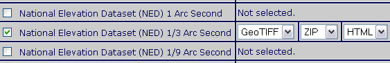
These are the USGS DEMs. All resolutions are listed but not necessarily available for your area. Use the highest resolution available for your area. Most areas do not have a 1/9 Arc Second (1 meter) resolution DEM. You can select more then one here if you want. For more about resolutions see the DEM Overview.
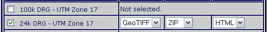
This is a topographic map. It contains location markings for buildings, trees, swamp areas, etc. and is useful to verify elevation data. 24k is the highest resolution version.
This is a black and white (or in some cases infrared color) satellite image taken in the 90's.
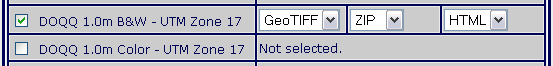
This is a high resolution color image. For the most part this image is only available in urban areas.
![]()
When you are finished, click Save Changes & Return to Summery.
The download screen appears with the items you checked. If an item doesn't show up then it is unavailable in your area. You can click Modify Data Request to go back to the list and make changes.
To download each item, click on the download button next to it. A new window opens. It may take awhile for it to process your request. When it is finished it prompts you to save. Repeat this process for the other items you want to download.Back to Terrain and Imagery Tutorial Main Page